Sunday, June 27, 2010

A great day out on SAR training

The story this week is similar to one of a year or more ago: a local Search and Rescue training day on 4wd drive preparedness and deployment in typical and unique South Island New Zealand high country braided river bed terrain. A great day out with friends it was too!

This year a new Police 4wd was initiated into the training day. To me it seemed incongruous to see what is a common sight on our roads in this environment, but it's really such a good idea that the need has been recognised and resources committed...albertburn-15.jpg

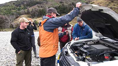
Local farmer Mike on the left, whose life and livelihood integrates crossing the Makarora river on a daily basis discusses the line with my neighbour PC Mike [in orange] and our group...
albertburn-1.jpg

After a deep immersion we examine where water got into which parts of the engine area, and where to watch and seal off so the vehicle stays functional [and intact!]
albertburn-19.jpg

Since farmer Mike, apart from being a fundamental corner stone of our group, has a farm to run we took time to allow him and his dogs to muster some cattle...
albertburn-113.jpg

They were a docile bunch, and the dogs had to work very hard to get them onto better food uphill...
albertburn-44.jpg

Lunch just up the hill from the cattle. Head of Lake Wanaka beyond...
albertburn-65.jpg

Looking down at the Nottingly River. Sadly John Sarginson a legendary run-holder of Mt Albert Station drowned in this creek. You can see a hut near by the large trees in this photo, and towards the right back from the lake by a poplar is where the original Mt Albert Station homestead used to be prior to being abandoned and subsequently burning down [1930 I think]...
albertburn-60.jpg

Above mentioned hut... so awkward and remote to get to it's sometimes thought to be mythical
albertburn-81.jpg

We travelled down the lake shore even further to an even more legendary, but seldom visited sheltered cove on Lake Wanaka to the site of an old wharf. By my calculations it's been 25 years since I've been here, and on that occasion with one close friend we were focused on getting to the East Matukitul valley on a 4 day tramping and mountaineering adventure. So this visit was very special to me, and that I had time to absorb this amazing spot and it's history. Sure you could get here by boat, but few do as there are no launching areas nearby despite the Haast/Wanaka highway just being across the lake. To have driven here by 4wd was rather unique as well...

albertburn-111.jpg
albertburn-104.jpg

albertburn-108.jpg

The training continued though and we tested a new winch...
albertburn-116.jpg

albertburn-123.jpg

Mike poses by his Cruiser...
albertburn-121.jpg

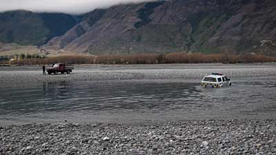
We head carefully home driving with the current rather than against it. These lighter vehicles tend to want to float too, so just like on foot, it's critical to go with the flow...
albertburn-126.jpg

I made this shot out of the Land Cruiser's window! The Makarora is one big river...
albertburn-130.jpg

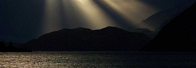
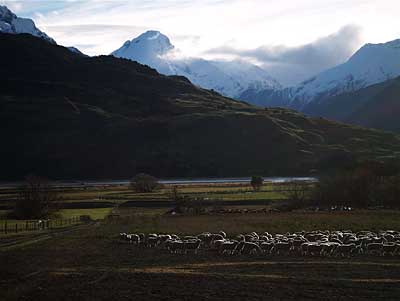
Mountains and shadows [the upper fuzzy profile of ridges is the shadow caused by the setting sun highlighting the mountains behind the "real" looking ones, and the shadow is in essence projected onto the low cloud we suffered all day]
albertburn-131.jpg
... and "yes" dear readers, the new camera is wonderful. I can't believe how the technology keeps improving so dramatically. Mind you learning all it's features may take me months!


Labels: , , , , ,

Share |

Tuesday, February 2, 2010

Makarora bat survey

We found some endemic long tailed bats last night. "We" being some local DOC staff and myself, a happy and oft present volunteer.

Not in the bush as expected, but where the road looked out on braided river bed. These little critters prolific in many parts of our country many years ago maybe among the oldest mammals living in New Zealand.

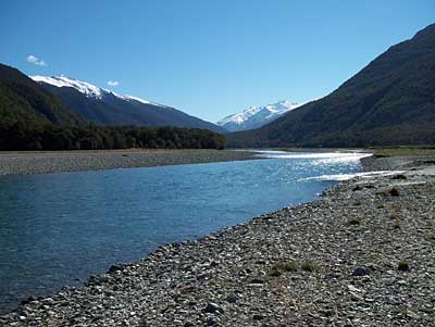
A daylight shot I made on a DOC braided river bed bird survey a couple of years back. The view is very close to where myself and Ute found our bats...

makarora-river-1.jpg


They're about as big as a mouse and capable of 60 Km/hr flight and feed over vast areas [the rest of the time they roost in trees not caves].

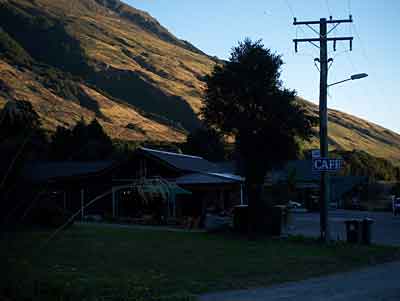
The survey started on dusk in the sleeply nearby tourist stop, Makarora, on the highway to Haast...
makarora-2.jpg


In groups of two, we each we walked 5 Km split into 1 Km transects on the Haast highway, and used little black boxes that pick up the bat's sonar - the noise being like a static version of a mouse wearing shoes and running on a tin roof. This is the first confirmation of their existence since the the early 1900s. The gear I assume was borrowed from Fiordland National Park where they've not only found colonies in the Eglington valley, but captured some and fitted them out with transponders and tracked them.

It was too dark on our survey to make photos without a tripod, and besides time is of the essence, but this shot of us on a bird survey shows how we dress and also my good friend Stu, who thoughtfully includes me on these fascinating surveys...
stu.jpg

It was really exciting, and the walking was like luxury tramping as there were few cars and being on a road there was little worry with footing, then walking out of the totally dark bush and onto Cameron Flat with it's views of Mt Brewster, into the near full [moon] moonlight, was extraordinary.

Another exciting find some years back - one I was able to capture with the camera: a nesting Banded Dotterel [Tuturiwhatu] doing a "I'm wounded" dance, to lure me away from the nest...
tuturiwhatu-banded-dotterel.jpg

Many species compete for food on our unique and harsh braided river beds. Here local farmer and friend Mike crosses the Makarora. The truck incidentally sans floor mats and bungs so it'll fill with water and not float!...
mike.jpg

Labels: , , , , , ,

Share |

Sunday, May 3, 2009

The Clutha River - dam plans threaten the river and plans for a park and trail

Often we take what is on our back door-step for granted and I'm as guilty of this as anyone. One of the major sources of the 338km long Clutha is only several minutes away from my door, and just lately with insidious requests locally from Contact Energy for opinions on 30 yr. old plans to build 4 dams I've been jolted so much my rose tinted spectacles have been shaken off!

The view looking west last Sunday from the Lake Wanaka outlet, where The Clutha begins in our neck-of-the-woods...
clutha-1.jpg

I'm also aware the Clutha Mata-Au River Parkway Group is working to create NZ's largest river parkway along the entire 338km long Clutha Mata-Au corridor, including a river-length Clutha River Trail. Given the success of the Central Otago Rail Trail we're already pointing out the benefits that could come from these plans, that would bring thousands of visitors per year to enjoy something that is truly unique and awesome.

The Clutha very quickly develops a distinct character a Km downstream...
clutha-1b.jpg

Thinking this through along with the recent successful dark avatar protest on twitter and other social networks to draw attention to an ill-conceived NZ Govt legislation with regards to copyright on the web it's occurred to me we don't have to take on this fight alone. With blogs etc. we can draw attention to these outdated plans on an international scale.

And this character has seasonal flavours...
clutha-1a.jpg

Three of our largest lakes, Wakatipu [the well known alpine resort town of Queenstown is on it's shore], and my [home] Lake Wanaka and Lake Hawea spawn this amazing waterway renown for it's water colour, history and scenic route to the sea among other things.

And it's always so dynamic - alive to it's journey to the sea and at peace with it's path so-much-so it flows with astounding speed and purity...
clutha-2.jpg

Through an ever changing landscape...
clutha-3.jpg

All of this landscape inc. Mt Aspiring in the distance feeds the Clutha...
clutha-6.jpg

Along the way it picks up side streams...
clutha-7.jpg

It's embarrassing to me as a New Zealander to say that if we need more power that we should first conserve what we have: it must be too cheap, our cost for it, as we all waste it, especially businesses, and how we fail to build and design efficient housing that lies to the sun is nothing short of disgraceful. But wait, there is more: we also let large corporations play with pricing and supply, not to mention our Govt...

I often wonder why we allow power from Fiordland's Lake Manapouri to be sold to the Comalco Aluminum Smelter at Bluff for an undisclosed sum. From this I assume it's sold very cheaply, so why don't we claim back our energy and use it for ourselves? I think we'd make more from it!


We need to get away from the concept of "owning" water and land - we are only the caretakers!

If you wish to pass on your views to Contact Energy this email address was published recently in one of our local newspapers: cluthahydro@contactenergy.co.nz

They also run a forum [pity it's moderated - there is nothing transparent in this as they can choose to not publish opposition!]

And on their site there is a form for email

Lastly while I can't provide heaps of great New Zealand landscape photography of the route the Clutha takes to the sea, I here include a selection of some of the sources. The Shotover complete with troublesome "wilding" larches...
clutha-5.jpg

The Wilken and Makarora river valleys...
clutha-8.jpg

Matukituki River and Shotover Saddle in Mount Aspiring National Park...
clutha-9.jpg

The Matukituki entering Lake Wanaka near Glendhu Bay...
clutha-10.jpg

Site head's up for this week: If you'd like to know more of the nature of the Clutha, Pioneer Rafting have a flavoursome web site

Labels: , , , , , , , , , , , , , , , , , , , , , ,

Share |

Sunday, February 1, 2009

Being a tourist around Makarora

Makarora is only an hours drive west and it's a good road these days that goes all the way to the Haast on our New Zealand's west coast, and surprisingly I don't go there often. So taking advantage of my camper truck I headed off there straight after work on Friday, and stayed at Boundary Creek almost at the head of Lake Wanaka intending to fish but...

it was very wild and windy...
makarora400-.jpg

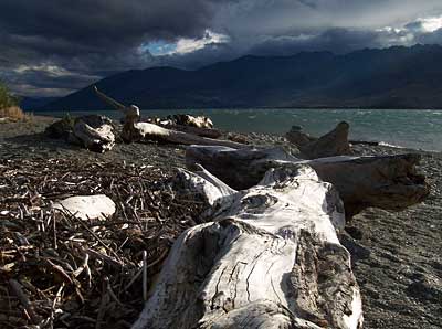
The Boundary Creek camping spot is actually on an alluvial fan formed by the creek having transported gravels out into Lake Wanaka many hundreds of years ago, and it's now vegetated with species that can withstand the wind it cops from up valley by being stuck out in the lake so-to-speak, but some surprisingly delightful sheltered spots can be found out of the wind, and one has only to step several metres towards the water to be assailed...
makarora400-2.jpg

I find it amazing how in landscape photography [or any of the photography disciplines for that matter] how a subject can look so different when viewed from multiple perspectives. This cabbage tree [or flax?] worn ragged by the wind is a good example when comparing the above and below shots...
makarora400-3.jpg

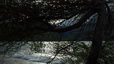
A lone willow leaning upwind yet putting out only one branch downwind...
makarora400-4.jpg

makarora400-5.jpg

makarora400-6.jpg

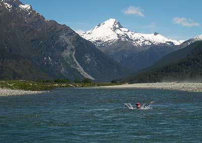
And up the road a bit at the Blue Pools on Sat. a tourist crosses the Makarora River...
makarora400-7.jpg

I caught up with a friend or two at Makarora, and headed home on Sat. in the face of persisting high winds and imminent rain. Now wide awake at 5 am Sunday, for some reason I hear the rain has caught up. It seems nice to be doing this my regular Sunday blog early to the sound of it, and the lovely smell the air has as it's being washed will be great to go back to sleep too!

On a totally different vein cousin Deirdre, a keen genealogist has emailed me this photo of our great great great grandmother Sarah Grimshaw's gravestone in East Hagbourne - blowing it up I see she was laid to rest in 1848. Somehow this connects in my mind to Capt. Cook's voyage and stop-over in 1773 in Dusky Sound, and how I was so taken by that on my trip there in 2005 - it feels strange to now know of a family link going back almost as far. A reminder too of our mortality...
grimshaw-grave.jpg

Labels: , , , , , , , ,

Share |

Sunday, November 16, 2008

Wanaka Search and Rescue exercise on river safety

Yesterday having crossed the mighty Makarora river by 4wd, we went up the Wilken valley to escape the wind and sand storms to carry out the following Wanaka Search and Rescue exercises:

River crossing in a group on foot and how to retreat, doing it solo, self rescue techniques, on foot with a patient in a stretcher, and 4 wheel drive strategies and safety in rivers.

Crossing the ever changing Makarora to the remote MtAlbert high country run - that's not a boat in the middle distance and the sandstorms can quickly strip the paint off of any sharp edges on car body work, should they be left parked in these exposed and silt laden braided river beds that are so unique to New Zealand...
wilken400-1.jpg

My friends using a mutual support technique in the Wilken...
wilken400-2.jpg

Self rescue practice using the "ferry gliding" technique, with the beautiful Wilken peaks in the background...
wilken400-3.jpg

We had it all wrapped by 2.30 and we headed back to the farm house, which is over the river from Makarora village, for a barbi of venison and organic sausages. One of my friends Mike is the manager of the farm and he taught the 4wd stuff. Since he's had eight years of crossing this river more than twice daily I learnt an awful lot about vehicle techniques - especially as pertaining to modern diesel trucks [he demonstrated with water over the head lights at one point, rather freaking out his passengers who suddenly found themselves getting their lower trousers wet - there are no floor mats and the thus exposed holes in the floor mean the truck fills up quickly so it won't float!]. There were a lot of my other old friends present on the day too, so we had a lot of fun in the sun, and managed to keep out of the raging nor west winds that prevailed preceding today's bad weather!

Bun in hand Mike describes some aspect of the day's exercises to Colin...
wilken400-4.jpg

This week coming up, weather permitting, we'll have an evening on helicopter safety.

Labels: , , , ,

Share |