Sometimes on reflection I find I hold an idea or a concept for many years, then one day without much thought at all I act on it.
I decided one Monday morning recently to pack bivy gear and sleep out/see the sunrise from the top of the locally dominant Roys Peak [just across Roys Bay, which is the main bay and beach by the town centre of Wanaka]. I wanted also to descend east from the top and go over Mt Alpha and down into the Cardrona Valley to get home.
To begin the trip by walking up the normal tourist route I got dropped off mid afternoon [wishing to avoid the heat and conserve water].
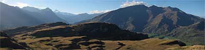
The tramp up was uneventful. I did meet the last of the day trippers coming down but few were talkative. However the view compensated...
I did the last hour or two in the dark, and as I approached the top I contemplated whether to carry on onto the unknown ground, however I decided not to. So having found a flat area I dropped to my knees immediately striping off damp clothes that were next to my skin, while stuffing cold cuts of meat into my mouth so I'd be in the best possible shape to weather what was already a very cold night, followed by a biggish day.
I cooked my meal from the shelter of my bivy bag, and contemplated that trips this time of year require many hours in the sleeping bag to simply keep warm while waiting for daylight. And thus began a 12 hr. night.
I lay for many hours looking straight up at the Milky Way, with the Southern Cross almost directly overhead. It looked much darker than this shot from teara.govt.nz. The sheer numbers of stars is boggling, but what is incomprehensible to me is the space, the void, that they populate. I defy anyone to be anything but humble in it's presence...
Part of me felt very alone and even a little scared - the effect of staring into the heavens in the gaps between what could barely be described as sleep, made me wonder if the nothingness that is everything, was now the norm., and I'd never see or feel our sun again. The concept of the infinity above me made our daily view of the world seem totally insignificant.
Most times in a bivy I'd poke as little of myself out of my sleeping bag and make a brew, but not this morning. From 5 am onwards was something to be simply endured, and at first light I crammed all in my bag, and quickly made this blurry shot from the summit and headed east...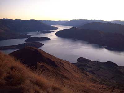 Sunrise minutes away...
 At last some sun...
 The first 10 minutes found me descending down a much steeper slope than I'd bargained for on frozen ground, that was as hard as the hobs... Sure I was stiff and cold, but I was awake enough to realise that I'd glossed over what may lie ahead. Namely all those rocks in the far distance that make up Mt Alpha...
 This view down Waterfall Creek fascinated me, and I marvelled that while I was feeling apprensively alive, the everyday world down there had not quiet woken up yet...
 The ridge was getting to feel decidedly lonely and alpine in nature - this had not been part of my expectations, especially it came as a shock being so close to town! A cold wind at my back was putting me off making a brew and breakfast too, but my not doing it may have had more to do with now being impatient and a little apprehensive to perhaps dig into myself for the goods to deal with whatever difficulties lay ahead...
 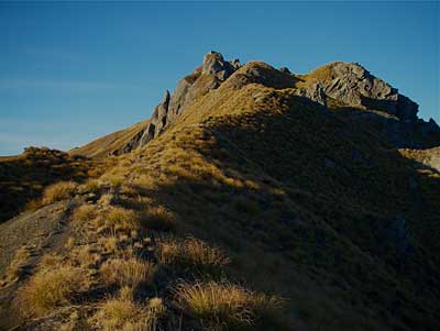 Now in amongst the bluffs with my ever enduring companion, the route was about to unfold for us - it was to be on the totally unwelcoming shady aspects of Mt Alpha. The ground was rock-solid, but I was thankful there was no powder snow underfoot...
In the midst of the bluffs, there were a couple of sketchy spots, one in particular involved a careful few steps across a gully that feed straight onto some nasty slabs - one of those places best dealt with by taking a deep breath, honouring the presence of a drop-off but putting it aside, then employing decisiveness so that should the footing be misjudged momentum would save the day.
When all said and done though, what was really faced was ourselves, and the view in there of Mt Aspiring far away on the left, and the closer Roys Peak to the right was worth a little minor digging into the inner resources... The self perceived difficulties and doubts are left behind as I reached easy ground and took my first sit-down breather and looked back...
 A tele shot of the big A, Mt Aspiring...
 A rock cairn and a plastic bird mark the entry of the descent for souls coming in the other direction...
 The Clutha Valley in the distance...
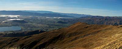 My descent is looking easy as it curves south into the Cardrona Valley...
 Looking back Aspiring is neatly framed by Mt Alpha and Roys Peak...
 Still a long way to go - it's 10.30 and I finally brew up and breakfast using the last of the 4 lts of water I budgeted for the alpine flavoured section...
 Unexpectedly the surroundings became quite interesting - this seeming ancient termination of a plateau with it's deeply incised gullies drops down into the head of Spotts Creek, and little did I realise that soon I'd be down there as well...
And down in the head of Spotts Creek... well the route was on a very dilapidated and steep 4wd track that had it's share of annoying vegetation, turns in directions away from where I wanted to be, and washouts with long un-called for grinds up hills. Somehow the urge to make photos dropped away from me, and besides my ride was waiting for me at 2 pm - it was time to turn up the speed!
Next day it was all but a wonderful memory as I caught up with Tigor for coffee and a muffin at Soul Food... notes:
 The route for this trip is marked with poles. Mt. runners sometimes do it in short order much faster than my own ramblings. Trampers, the few I've spoken with comment it's a long way and don't seem to like it's drawn out nature. My total time travelling with photos and not inc. eating was 10.5 hours
One thing for sure is, like the DOC warning signs at both ends say: it's exposed to the weather [1500-1640 mts above sea level]. Personally should snow be lying in shady aspects of Mt Alpha that too would be a significant and time consuming hazard to be turned into a difficulty by applying technique.
Labels: Clutha Valley, Lake Wanaka, Milky Way, Mt Alpha, Mt Aspiring, Roy's Peak, Roys Peak, Southern Cross, Spotts Creek, Wanaka, Waterfall Creek