Saturday, May 7, 2011

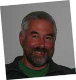
Ralph Warburton - photographer, mountaineer and mountain guide

Several years ago or more Ralph Warburton, a well known Wanaka local decided to publish a book of his life's experiences. As an Apple computer techy I got involved quite often assisting with the technology needed for authoring and self publishing.

Ralph sadly passed away subsequently, and so too perhaps in sympathy did his computer! But I'd been backing it up, and with his daughter's permission some years back, I'm posting here the images [colour slides] he had scanned.

Presumably I've posted the eastern [Mt Cook] photos in this first installment. I also presume it's not always Ralph featuring in the images [after all he was a professional photographer, as well as an accomplished mountaineer and mountain guide], but his late wife Joyce.

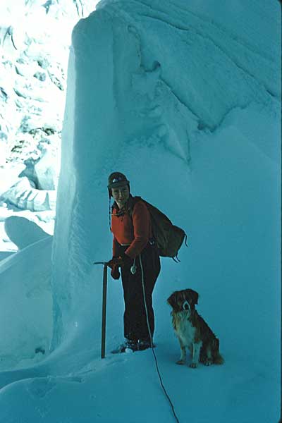
Ralph and Scott on the Tasman Glacier. Mt Cook in the background...
#alttext#

#alttext#

#alttext#

#alttext#

#alttext#
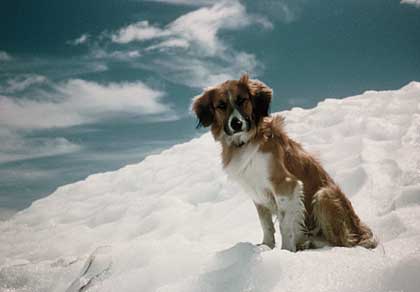
Mt Cook National Park was formed in 1953, and as such dogs would have then been banned in the area, so using this as a guide I'm guessing the images would have been made just prior. Certainly Ralph's book [link below] would aid this dating, but it's been awhile since I read it.

The old De la Beche Hut, Mt Cook in the background...
#alttext#

I wonder who this is? Probably the Hochstetter Icefall on the right, which may make the rock part of the ANZAC peak. I recall seeing a famous photo of Samuel Turner poised on one leg for the camera on this peak, so there is this association in my brain, but the date range would probably be too disparate for it to be him...
#alttext#

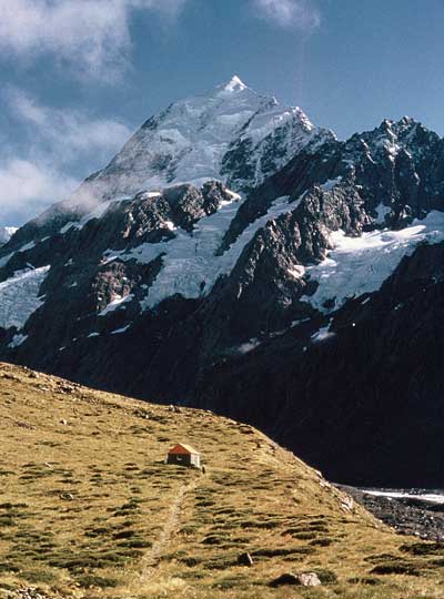
Hooker hut with Mt Cook in the background...
#alttext#

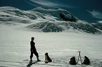
Upper Tasman Glacier with Hochstetter Dome in the background...
#alttext#

If anyone can add information to these photos please contact me via email.

You can purchase Ralph's interesting book here

The next lot of images below seem to be of the West Coast - this is where Ralph lived for quite a few years.

I think this'll be the old hotel at Fox Glacier...
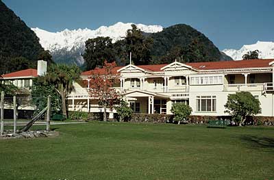
#alttext#

And this perhaps the old hotel at Franz Josef Glacier...
#alttext#

Guided group on one of the glaciers...#alttext#

#alttext#

#alttext#

#alttext#

#alttext#

Scott was indeed a very good climber...
#alttext#

#alttext#

#alttext#

This looks like the old I Pioneer hut that was destroyed by rockfall...#alttext#

Probably the head of the Franz Josef Glacier neve...
#alttext#

#alttext#

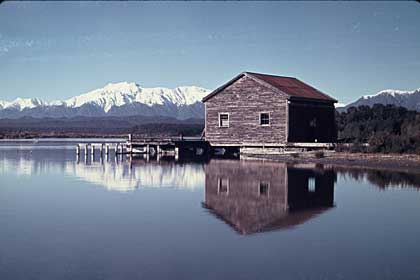
Okarito I presume...
#alttext#

I can only think these two men are gold mining the black beach sands. Possibly the Shaw Bros. of Gillespies Beach near Fox Glacier?...
#alttext#

Perhaps the same two fellows with Ralph and Scott...#alttext#

A Plogs anyone?...#alttext#

#alttext#

#alttext#

#alttext#

#alttext#

#alttext#

#alttext#

#alttext#

This looks suspiciously like it was taken looking down on the Grand Plateau - perhaps from Zurbriggins or the East Ridge of Mt Cook?...#alttext#

More recently the Ralph I knew at Wanaka, with Joyce...
#alttext#

#alttext#
Thanks Ralph - it was a pleasure knowing you

Cheers

Donald


Labels: , , , , , ,

Share |

Monday, October 11, 2010

North and South Mackenzie Country New Zealand - some contrasts, some environmental dilemmas

My son Dougal has always been keen on science, and with Uni. looming next year, I had the idea these recent school holidays to visit the Mt John astronomy observatory at Lake Tekapo in the northern Mackenzie country, so he could see first hand what goes on at this University of Canterbury outpost.

Before our "appointment" with manager Alan we left the beaten track the day before to spend the night in the seldom visited area encompassing Mt Cook Station. The trip and locality give a unique experience that is very different to the normal approach road to Mt Cook National Park. Essentially the route leaves Tekapo and heads overland to Lake Pukaki.

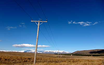
Enroute to Mt Cook Station...
braemar-power-pole-1.jpg

En-route to Mt Cook Station still - Braemar Dome. I've always fancied skiing these gentle big slopes, but access ain't easy..
braemar-2.jpg

Mt Sefton on the left and Mt Cook on the right. Our companions for our camp out in the truck just beside the wild and cold Tasman River. However the Dept. of Conservation seems to be doing a wonderful job here, as many banded dotterel actually wandered around the truck - curious I guess. How wonderful to witness this as they're an endangered species...
sefton-cook-3.jpg

A nesting banded dotterel shot I made a year or two ago, while helping DOC on a braided river bird survey...
banded-dotterel.jpg

Heading back to Tekapo we were witness to some impressive stock handling and dogs...
braemar-sheep-4.jpg

And we met John the grader driver. He'd got his 18 ton machine bogged. While I had no hope of pulling him out with a 2.5 ton Land Cruiser, his colleague nearby in another grader did so in short order. John has spent 27 years, summer and winter keeping all Mackenzie Country secondary roads clear and in order...
braemar-john-grader-5.jpg

Our NZ military use a great swathe of land to practice on. It says what they leave lying around could kill you...
braemar-warning-6.jpg

close-up-warning.jpg

It seems a real shame they've laid claim many years ago to what is a fragile environment then driven and shelled hell out of the place, leaving wounds in the landscape that may never heal...
braemar-military-ruts-7.jpg

Mt John Observatory...
mt-john-8.jpg

Alan gave a fascinating and insightful tour. Here Dougal inspects the new 1.8 meter [mirror] telescope. What Alan, his wife, team, and University of Canterbury astronomers are doing there is very inspirational [see link below]...
1.8m-telescope-9.jpg

So what are some of the contrasts and dilemmas?
The Mackenzie is just one of many unique areas in this compact country, but I know it quite well - I used to live there, so did my grandfather who was a musterer, fencer and shearer.

Lately it's increasingly been coming to the forefront of news. I think people are noticing the unique landscape more, maybe because quite recently it's been changing due to new intensive farming styles. Many want it back how it was, but for this we sadly have to go back much more than several years.

But times are a changing and just last week the head of the Department Conservation (DOC) was calling for urgent and "radical" change in a refreshingly honest presentation [see link below].

Anyway this is some of what I've seen and figured out [with massive thanks to many conservationists, soil conservators, Dept. of Conservation staff, farmers, visionaries, historians, restoration ecologists, and friends - you know who you are!]...

The Tekapo area is actually quite high altitude - cold and windy. But the southern Mackenzie is a bit more user friendly. Trouble is it's all suffered degradation from the late 19th century onwards, when it was all apparently waist deep in snow and red tussock. I should imagine moa would have roamed there a long time ago.

But for most of my life time vast areas have looked like this...
benmore.jpg

Hieracium infestation seems to kill off snow tussock and most other grasses. It's very invasive in some areas - rabbits have been part of it. It's only saving grace is it looks pretty in Nov. each year, but stock cannot eat it. Note the Twizel township and Twizel and Fraser rivers in background...
hieracium.jpg

Down by the Twizel and Fraser rivers it becomes evident that irrigation totally changes the eco system, just like hieracium and rabbit infestation. However in this instance the irrigation is more natural and much less energy dependent - this is probably reclaimed wetland, point being that the grasses are deep rooted and not superficial, therefore more able to cope with the extremes of climate typical of the area, and maintain old time habitats...
ruataniwha.jpg

And the hand of man also changed the scenario in yet another way in the 1970s, with a series of canals and power stations. The project developers did an amazing job under budget always [politicians kept at bay so there was minimal ego informed bungling], and gave us an asset that actually [unlike the Clutha's Clyde dam debacle], produces a lot of energy. But there was a cost, despite their mandate to leave the land better then they found it: We lost wetlands, wild rivers and even a gorge so wild and remote few know about it, for back then these features were not seen as assets...
ohau-b.jpg

Old time locals have been pushed into smaller areas. And what they live on has been altered by all scenarios so far mentioned. It seems minor, but that green blur is a "wilding" pine tree. Yet another highly invasive weed in NZ's high country, that is especially a huge almost incomprehensible problem down-wind from the above mentioned Mt Cook area...
falcon.jpg

So just as maybe a hundred years ago, the landscape is changing yet again! Now we have the New Zealand version of crop circles, but in our case there is no mystery or aliens - they're called pivot irrigators...
pivot-circle.jpg

So we have two extremes down on the flats in this photo looking towards Lake Ohau, and neither are favorable hosts to the native snow or red tussock, and all the bugs and birdlife that can live with them...
ohau-irrigation.jpg

The latest mooted change in the southern Mackenzie, is diary cattle will have huge sheds to live in - so called cubicle farming. These plans of a few farmers are causing quite a fuss right now, with claims this will improve things, and counter claims from conservationists, [who in some instances perhaps think the status quo of 2-3 years ago is desirable]. The intensive farming lobby argue that they're stopping the scarce soil from eroding away, and actually creating new, but seemingly almost as an aside, water quality issues compromised by effluent get glossed over.

But all this irrigation is actually making even more changes to the eco systems - those places where numerous bugs live. Many are rare apparently.
I might be more impressed if their grasses and techniques could survive drought - in other words be less dependent on technology [it often costs a lot to pump water to irrigators]. I don't seem to see enough evidence of sound dry-land farming techniques that have been impressively employed by the established fine wool farmers for many years. And, yes, rabbits don't like it green, but neither will snow tussock establish easily [once mature/established, they're more tolerant]. Sadly I see few attempts to establish corners, corridors or shelter belts comprised of these natives, and others.

So for our children and future generations, how do we get back more areas to something approximating this scene...?
bindu.jpg

As I drove back home over the Lindis Pass, a reserve of snow tussock, yet again, just as I've noted for years, they're just surviving and not really recovering at all to waist deep status...
lindis-tussock-10.jpg
Restoration ecology is a huge challenge in the Mackenzie because of the scale, but one we could easily win at with cooperation, less greed and more education.

More treasuring what we've been gifted by nature would help, as would more acknowledgement that there are many old time farmers who've achieved great insights and land management skills, and a Dept. of Conservation that is staffed at ground level by people with a passion for their work, and now headed by a manager who sees things with a big picture in mind, and is not afraid to speak out.

We have more resources than we think!

It's all about perception! We need to lift our awareness that we are the land, and not stuff it all up - then we'll all be healthier in mind and body.

Links:
NZ "trashing our environment" - Dept. of Conservation chief speaks out
Dept. of Conservation's efforts in the Twizel area
Mt John observatory
Mackenzie Guardians...
Forest and Bird's Save our Mackenzie Country

It does not seem to help that either end of the Mackenzie is administered by different Councils. Environment Canterbury and Waitaki

Labels: , , , , , , , , , , , ,

Share |